![[internet geography]](../images/pagelayout/netgeologo.gif)
![]()
Physical Geography
Coasts
Earthquake
Ecosystems
Glaciation
Limestone
Plate Tectonics
Rivers
Volcanoes
Weather and climate
National Parks
Human Geography
Landuse
Migration
Urbanisation
Economic Geography

|
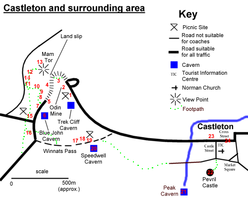
Castleton
& surrounding area Place your mouse over the numbers on the map below to find out what the corresponding photograph shows. You may have to wait for a few seconds for the information to be displayed. Click the number to see the photograph. Click 'Back' on your browser to return to this page.
|
![]()
GeoNet is not responsible for the content of any of these sites
The Peak District National Park - Castleton - A Tourist Village?